
GobackpackGo
  • Home
  • Countries
    • Australia
    • Europe
      • Denmark
      • Estonia
      • France
      • Germany
      • Italy
      • Latvia
      • Lithuania
      • Norway
      • Sweden
      • Switzerland
      • The Netherlands
    • Asia
      • Cambodia
      • China
      • Hong Kong
      • Indonesia
      • India
      • Japan
      • Laos
      • Malaysia
      • Myanmar
      • Nepal
      • Singapore
      • Sri Lanka
      • Thailand
      • Vietnam
    • Africa
      • Botswana
      • Morocco
    • Cycling holidays
      • TourduPisa
      • TourduGermany
      • TourduEurope
  • Travel
    • Travel tips
    • Travel e-SIM Card
    • Buy local sim card
    • e-SIM For Laptops
    • Holiday Car Rental Tips
      • Car Rental Australia
      • Car Rental New Zealand
    • Airport Car Rental
    • Yacht Charter
    • Compensation delayed flight
    • Travel Inspiration
  • About me
    • Featured articles
    • Supporting Kiva
  • Contact

Huay Tung Tao Cycling from Chiang Mai: Flat Route, GPX and Lunch (34 km)

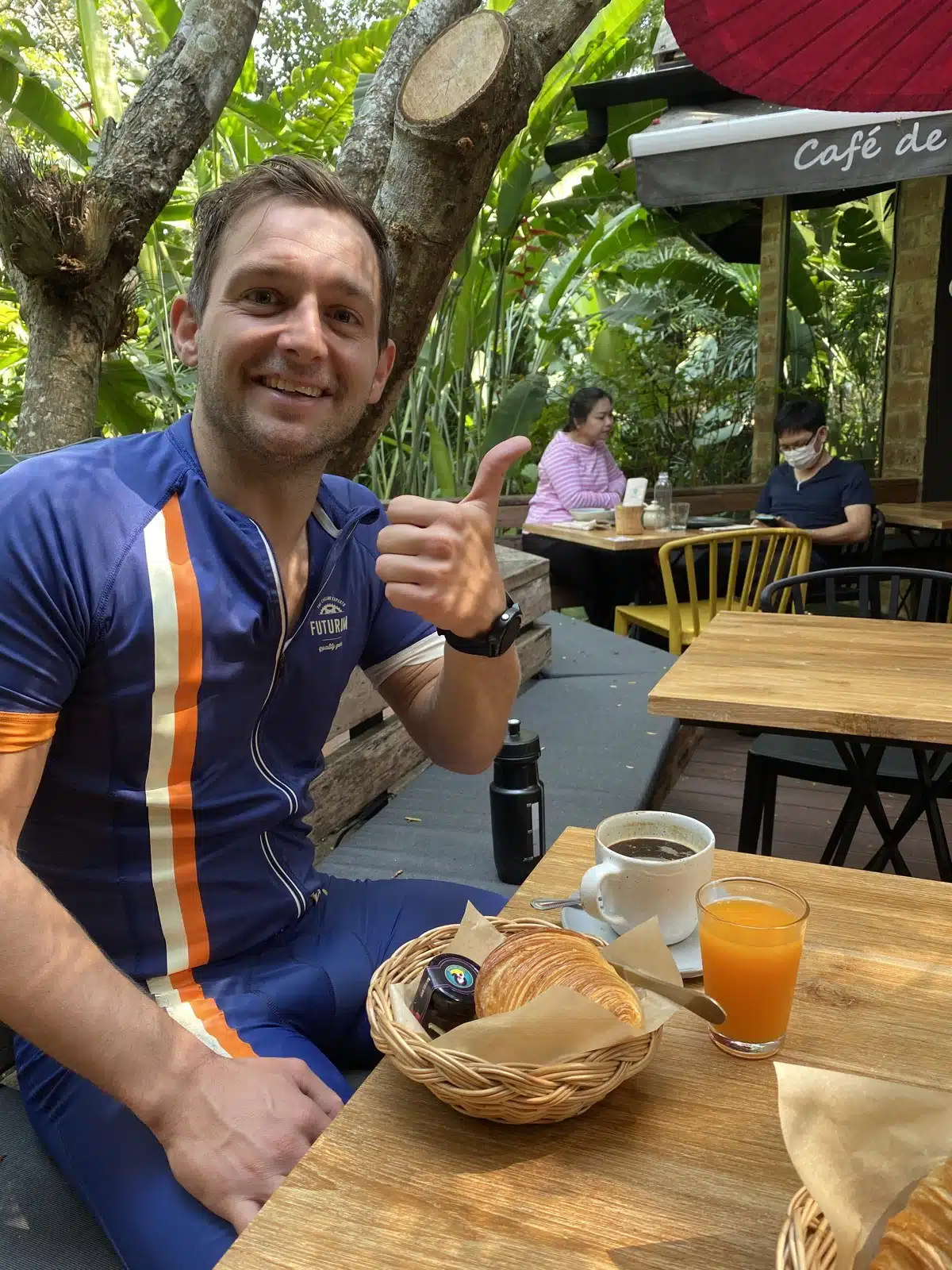
Paul in cycling kit giving a thumbs-up at Cafe de Oasis after Huay Tung Tao cycling

Huay Tung Tao cycling from Chiang Mai is the flat ride: 34 km out and back from Suthep Road, about 2 km west of the Old City, with one lap of the lake road and less than 100 m of climbing in total. The lake is also written Huay Tueng Thao. I rode it on Saturday 1 February 2020 with a cycling friend, just to discover a new flat route. It became 57 km: we ended up riding the lake road eight times, and finished with lunch in town.

Smart move: save this guide now, so it is there when you need it on the road.Save to PinterestPinterestEmail it to myselfEmailSend to a travel buddyWhatsApp
Distance 34 km with one lap of the lake (about 3.7 km per lap); our ride with 8 laps was 57 km
Climbing less than 100 m: between about 310 and 370 m above sea level
Our time start 8:26, first lap 9:53, last lap done 11:50, lunch around 12:30
At the lake giant straw figures in the Huay Tueng Thao Sculpture Park, drinks and fresh coconuts, restaurants on the water
Lunch Cafe de Oasis, Nong Ho Road

Huay Tung Tao cycling route: GPX and elevation profile

The GPX starts and ends on Suthep Road, about 2 km west of the Old City, follows our Strava track north to the lake, does one lap of the lake road and comes back past Cafe de Oasis. Add as many laps as you like. It works on a Garmin or Wahoo and in Komoot, Organic Maps or OsmAnd.

Download GPX (34 km)Open in Google Maps

Google My Maps: KML file

Huay Tung Tao cycling elevation profile: flat, between about 310 and 370 m, 34 km
Flat all the way: the lake road is only a few dozen metres higher than the city

Why ride to Huay Tung Tao Lake

Most rides around Chiang Mai go up: Doi Suthep, Doi Pui, the Samoeng Loop. This one does not. The road north to the lake is flat, and the road around the lake is a short loop you can ride again and again. That makes it a good ride for an easy day, for a first ride after you arrive, or for training laps. On our way out we shared the road with a flock of sheep and goats.
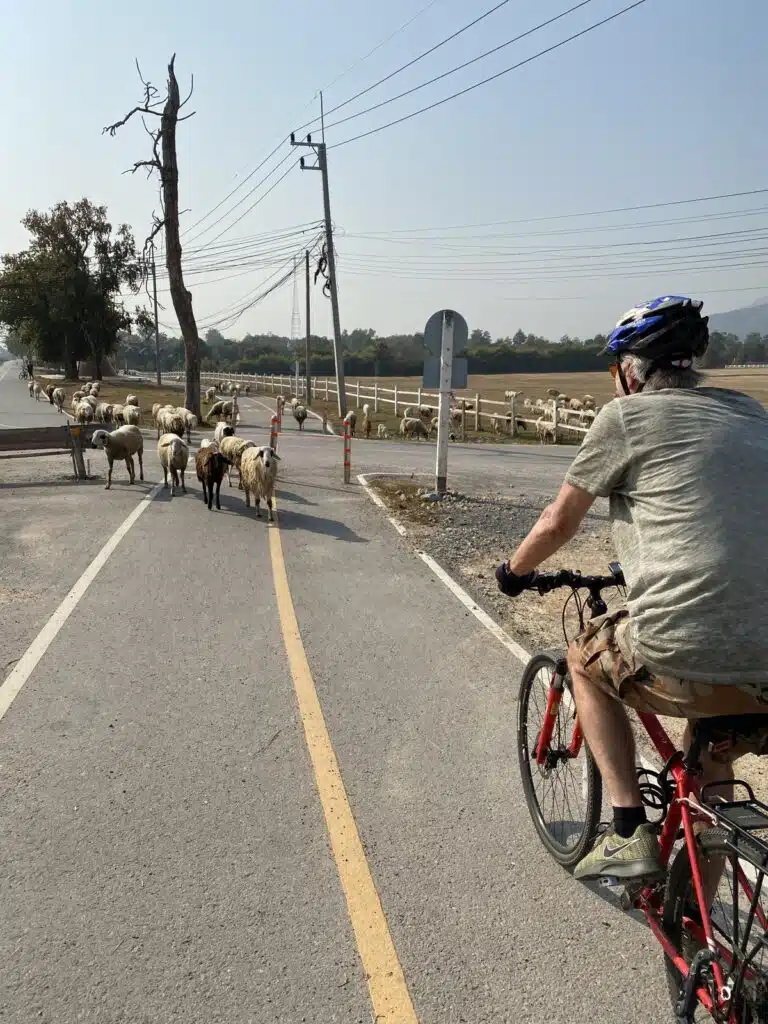
Cyclist on a flat road towards Huay Tueng Thao lake, passing sheep and goats
My cycling friend on the flat road to the lake, with sheep and goats on the road

At the lake: giant straw figures and food on the water

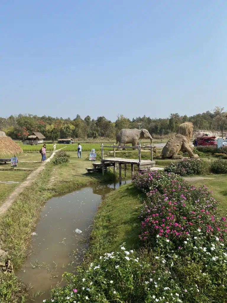
Around the lake you ride past huge figures made of straw, standing in the fields along the water: the Huay Tueng Thao Sculpture Park (Google Maps). We stopped for drinks, a fresh coconut and water. There are restaurants on the water too, a good place to eat if you come back from the Samoeng Loop or if you just ride out for lunch.
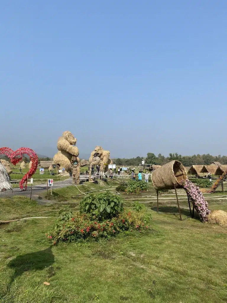
Giant straw sculptures in the fields at Huay Tueng Thao lake near Chiang Mai
Huay Tueng Thao Sculpture Park: giant straw figures by the lake, February 2020
Straw elephant and huts along a canal at Huay Tueng Thao lake
A straw elephant along the water, February 2020

Lunch on the way back: Cafe de Oasis

On the way back we stopped for lunch at Cafe de Oasis on Nong Ho Road (Google Maps): fresh juice, eggs and coffee. Still open in October 2026; check the opening hours on Google Maps before you ride.
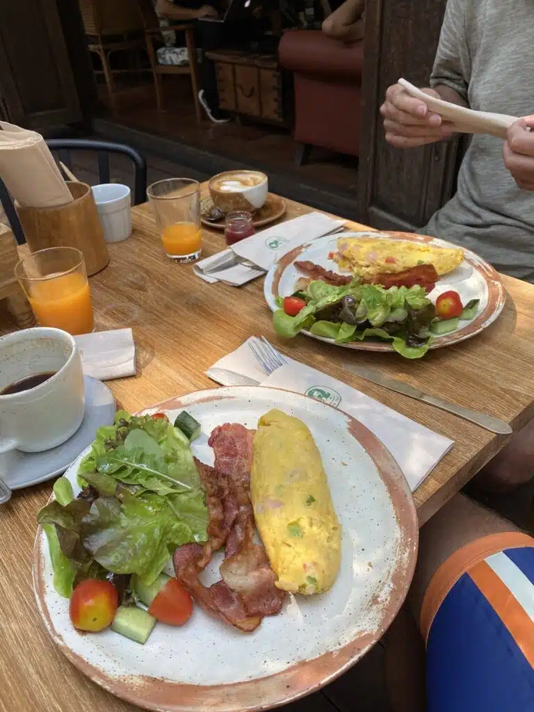
Lunch with omelette, bacon, salad, orange juice and coffee at Cafe de Oasis in Chiang Mai
Juice, eggs and coffee at Cafe de Oasis

The day before the Samoeng Loop, twice

This flat ride was on Saturday 1 February 2020. The next day I rode the Samoeng Loop twice in one day, 162 km. If you are in Chiang Mai for a while and want to ride hills, the lake is a good easy day in between: Samoeng Loop cycling, Doi Suthep cycling or Doi Pui cycling.

More cycling and Chiang Mai

  • Samoeng Loop cycling: 81 km with GPX
  • Doi Suthep cycling: the 10.7 km climb to the temple (GPX)
  • Doi Pui cycling: all the way up to 1,537 m (44 km, GPX)
  • Cycling tours in Chiang Mai
  • Our Thailand guide

FAQ

Is the ride to Huay Tung Tao Lake flat?

Yes. Our 34 km GPX has less than 100 m of climbing, between about 310 and 370 m above sea level.

How long is the Huay Tung Tao lake loop?

About 3.7 km on our track. We rode eight laps, between 9:53 and 11:50, including a stop for a coconut.

Is there food at Huay Tung Tao Lake?

Yes, there are restaurants on the water, and drinks and fresh coconuts.

Where to have lunch after the ride?

We went to Cafe de Oasis on Nong Ho Road, on the way back into town; it was still open in October 2026.

Distance and times: our own Strava recording (1 February 2020, Strava). Heights: Copernicus DEM GLO-30 (© DLR e.V. 2010-2014 and © Airbus Defence and Space GmbH 2014-2018, provided under COPERNICUS by the European Union and ESA), checked against SRTM and ASTER, not the altitude of the watch. Checked 26 October 2026.

Paul Ram

Written by Paul Ram · updated 26 October 2026

I am Paul from Amsterdam and I have been writing GoBackpackGo since 2013, from my own trips through 32 countries and 1,000+ days on the road: backpacking in Asia (2014 and 2023–2024), road trips in Australia and New Zealand, and bikepacking trips in Europe.

More about me · Instagram (17.9K followers) · Strava · YouTube · Pinterest

Tags: Chiang Mai, Cyclingtour
Previous Post
Doi Suthep Cycling from Chiang Mai: Route, GPX and the Morning Ride (29 km)
Next Post
Golden Triangle Loop from Chiang Mai: Our Route, Map and GPX (798 km by Scooter)

Leave a Reply Cancel reply

Your email address will not be published. Required fields are marked *

Fill out this field
Fill out this field
Please enter a valid email address.
You need to agree with the terms to proceed

Hi, I’m Paul

Paul from GoBackpackGo

Outdoor and sports enthusiast. Since 2013 I’ve been backpacking, bikepacking and motorbiking through more than 30 countries, and writing about it on GoBackpackGo. Everything here comes from my own trips, routes and real costs.

More about me →

Travel tips

Get a local travel simcard
Ready within minutes

Get compensated for a delayed flight
Super easy to claim

Charter a yacht
Plan your sailing trip

Tips Car Rental
Rent a car with confidence

© 2026 GObackpackGO

Manage Consent
To provide the best experiences, we use technologies like cookies to store and/or access device information. Consenting to these technologies will allow us to process data such as browsing behavior or unique IDs on this site. Not consenting or withdrawing consent, may adversely affect certain features and functions.
Functional Always active
The technical storage or access is strictly necessary for the legitimate purpose of enabling the use of a specific service explicitly requested by the subscriber or user, or for the sole purpose of carrying out the transmission of a communication over an electronic communications network.
Preferences
The technical storage or access is necessary for the legitimate purpose of storing preferences that are not requested by the subscriber or user.
Statistics
The technical storage or access that is used exclusively for statistical purposes. The technical storage or access that is used exclusively for anonymous statistical purposes. Without a subpoena, voluntary compliance on the part of your Internet Service Provider, or additional records from a third party, information stored or retrieved for this purpose alone cannot usually be used to identify you.
Marketing
The technical storage or access is required to create user profiles to send advertising, or to track the user on a website or across several websites for similar marketing purposes.
  • Manage options
  • Manage services
  • Manage {vendor_count} vendors
  • Read more about these purposes
View preferences
  • {title}
  • {title}
  • {title}